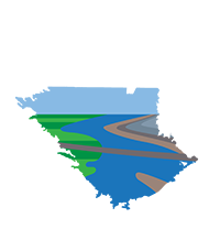
The Amended Kern County Subbasin Groundwater Sustainability Plan (GSP) has been prepared by 20 GSAs and one coordinated groundwater management area. Each GSA applied for and was granted exclusive GSA status for a portion of the Subbasin under CWC §10723(c) and §10723.8. All GSAs use the Kern County Subbasin GSP (sometimes referred to as 2024 Plan) elements as its foundational Plan; however, six GSAs provide supplemental information that is inserted as blue pages throughout their GSP. The crosswalk table summarizes the contents of each GSP.
GSPs
includes Arvin, Cawelo Water District, Kern Non-Districted Lands Authority, Kern River, Kern Water Bank, Greenfield County Water Districts, North Kern WSD, Pioneer, Rosedale-Rio Bravo WSD, Shafter-Wasco ID, Southern San Joaquin MUD, Tejon-Castaic Water District, West Kern Water District, and Wheeler Ridge-Maricopa GSAs
Foundational Plan that covers all required elements for the Subbasin.
Appendices
- Appendix A – Incomplete Determination Letter
- Appendix B – Inadequate Determination Letter
- Appendix C – Second Amended Coordination Agreement
- Appendix D – Kern Non-Districted Lands Authority JPA
- Appendix E – Kern Fan Water Banking Programs
- Appendix F – Kern Water Collaborative MOU
- Appendix G – General Plan Land Uses, Policies and Goals
- Appendix H – Stakeholder Communication and Engagement Plan
- Appendix I – Summary of Outreach and Engagement Opportunities
- Appendix J – FWA Letter of Support
- Appendix K – Kern County Subbasin Mitigation Program
- Appendix L – GWQ Considerations for High and Medium Priority Basins
- Appendix M – Supporting Water Budget Tables C2VSimFG-Kern Model
- Appendix N – Validation and Performance Assessment of C2VSimFG-Model
- Appendix O – Alternatives Evaluation of GWL MT Approaches
- Appendix P – GWL Hydrographs with SMC
- Appendix Q – Well Impact Analysis by Well Type
- Appendix R – Chemographs with SMCs
- Appendix S – Individual GSA PMA Sections
- Appendix T – INTERA SOW to Support Subsidence Mitigation Cost Analysis
- Appendix U – Basin Study Scope of Work
- Appendix V – LandIQ SOW for ET Data Analysis
- Appendix W – MT Exceedance Policy
- Appendix X – Representative Monitoring Network
- Appendix Y – SOP Water Levels Measurements
- Appendix Z – SOP Water Quality Sampling and Reporting
- Appendix AA – Public Comment Letters and Responses
Kern Subbasin GSP plus supplemental blue pages to emphasize the complexity of the basin setting across the GSA boundary, a description of water supplies, and its history of sustainable groundwater management.
Kern Subbasin GSP plus supplemental blue pages to demonstrate that the GSA has been operating sustainably since the implementation of SGMA and discusses future practices planned to maintain its sustainability.
Kern Subbasin GSP plus supplemental blue pages to provide information of its jurisdictional boundary, groundwater levels and pumping from the Santa Margarita Formation – the primary aquifer supplying its groundwater, and details on management action KTWD-8 which modifies the districts pricing structure.
Kern Subbasin GSP plus supplemental blue pages to demonstrate how the GSA possesses several distinct characteristics that make it unique, how it is achieving the sustainability goal, and is undergoing sustainable management.
Kern Subbasin GSP plus supplemental blue pages to highlight actions taken by the GSA to implement demand management activities that will ensure it reaches sustainability at or before 2040 and provides additional information on its groundwater banking project operations, as well as its use of remote sensing to estimate evapotranspiration as a significant tool for managing demand
Kern Subbasin GSP plus supplemental blue pages pertaining to conditions and characteristics unique to the GSA that demonstrate it will achieve sustainability. Additional information highlights the unique hydrogeologic conditions including naturally degraded groundwater quality; details of local studies related to the cause, rate, and extent of subsidence; and information on projects and management actions that maintain sustainable groundwater management within its GSA boundary.
Supporting Documents
Annual Reports
Other Documents
Draft Stakeholder Communication and Engagement Plan
Kern GSP Outreach Meeting Presentations
On October 3, 2024, Public Outreach meetings were held to provide information about the Kern GSP.
Public Outreach Presentation english | espanol
Public Outreach Zoom Recording
SWRCB Workshop Presentation from Kern Subbasin GSAs
Watch the SWRCB’s Public Workshop.
Forward to the 2:08 time stamp to hear the Subbasin’s presentation.
